…the characteristic Shoalhaven landscape, the division into thirds: sky, earth, water. – Darleen Bungey, in Arthur Boyd: A Life
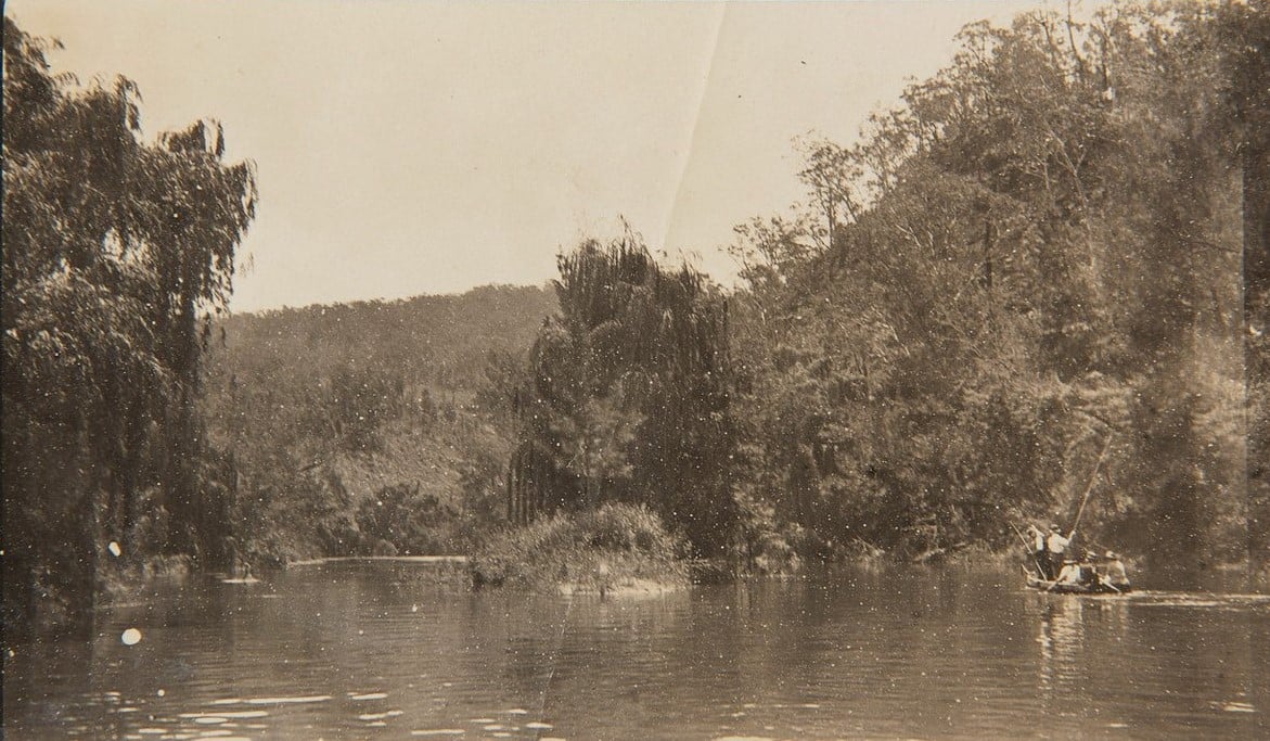
The geophysical character of the Shoalhaven River Valley indicates millennia of deposition and erosion. Imposing banded blocks of sandstone force the river to turn and change its course.
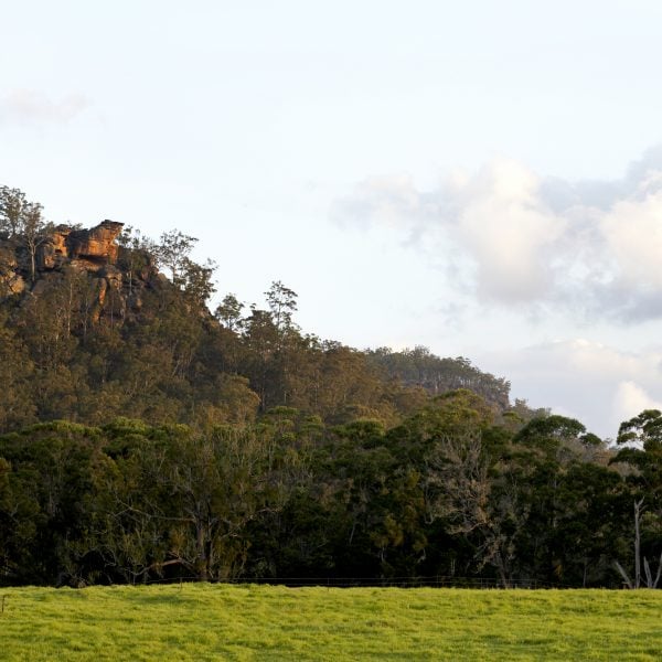
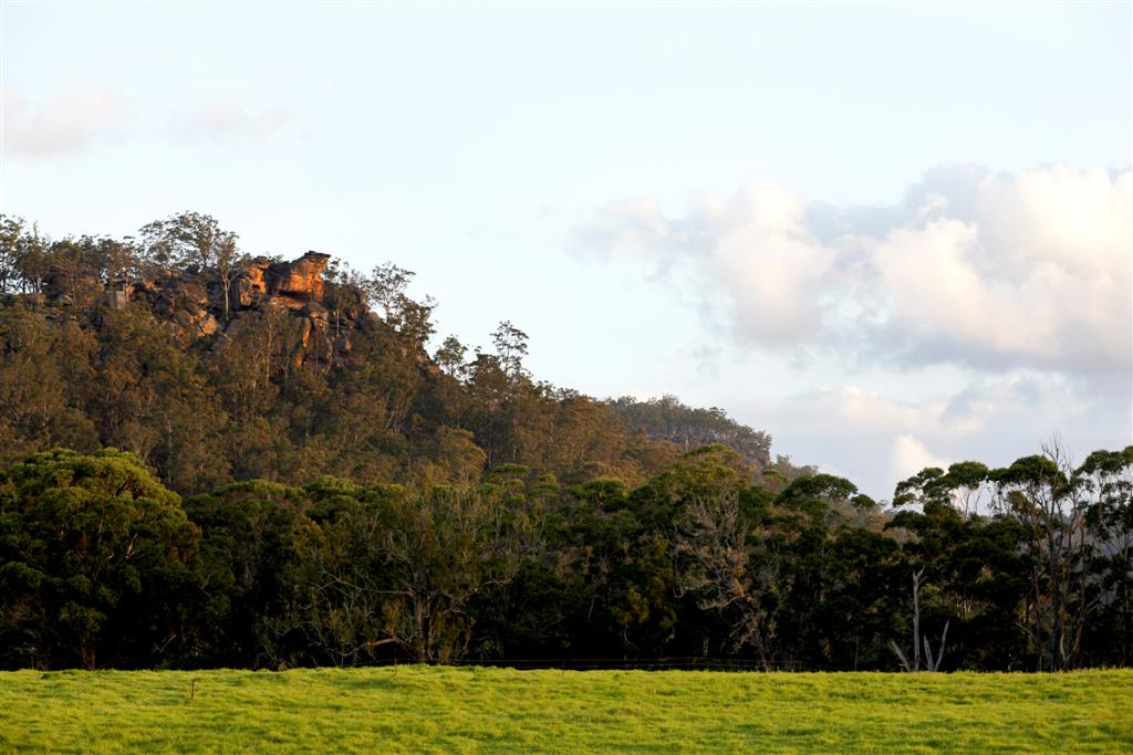
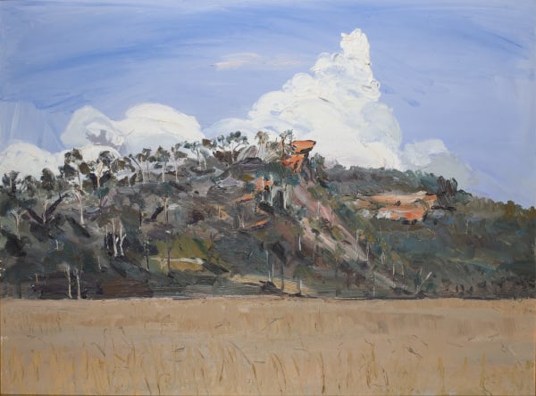
A deep trough has been gouged through sedimentary rocks to form the Shoalhaven River Valley. The most obvious of these colourfully layered cliffs is Pulpit rock which is located on the opposite bank of the river to the Bundanon homestead.
Topography
The landscape can generally be described as being an eroded plateau of sedimentary rock. The distinctively horizontal bedding of the sandstone plateau has eroded to form vertical cliffs that rise to 50 metres tall in places. The pattern of shear rock faces on the outer bends of the river and wide flat paddocks on the inner bends is repeated along the property’s river frontage. Smaller creeks that drain into the river from the Bundanon properties have further eroded the plateau to create fingers of rock that reach out to the river as it meanders past the property.
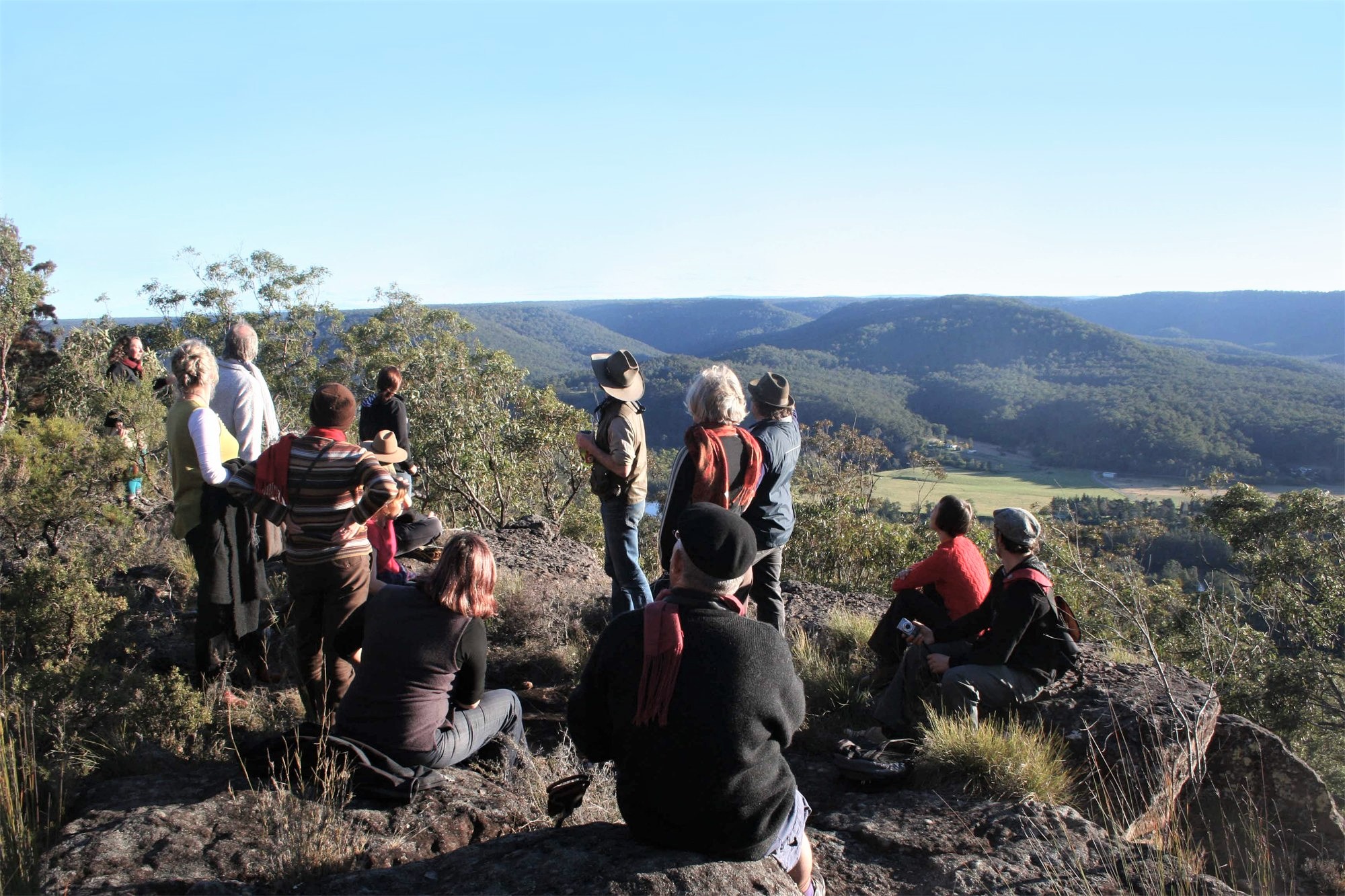
There are a number of significant features of the landscape, including Pulpit Rock, on the southern side of the Shoalhaven River opposite the Homestead; The Amphitheatre, located under the northern escarpment above the Homestead; and the steep sandstone cliffs below the Burrier road, opposite Eearie Park.
GEOLOGY
Permian Period
Nowra Sandstone is comprised of Quartz and Sandstone. These are located on the top of the ridgeline to the east of the High Voltage Electricity easement where the Berry Formation has been completely eroded. The soils along this narrow ridge are extremely shallow or non-existent; bare, rock outcrops predominate and deeply eroded fissures are common. Wide clefts in the parent rock have created deeper pockets of soils that have to a greater or lesser extent been eroded.
WandrawandianSiltstone is comprised of Siltstone, Sandy siltstone which may be pebbly in part. This geology is situated on the side slopes of the narrow ridge line down to the river or to the river flats. The soils overlying this rock are deeper than the ridge top soils and have formed through the deposition of soils eroded from the Berry Formation and the Nowra Sandstone upslope, and by the in situ decomposition of the Wandrawandian Siltstone parent material.
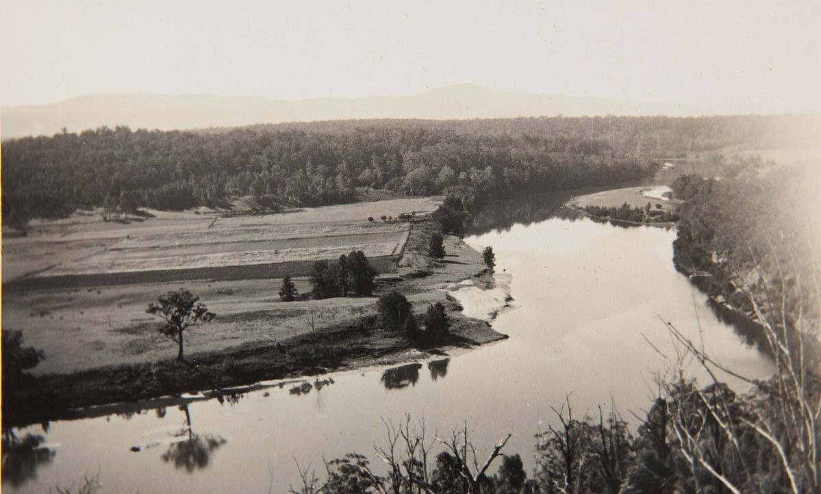
ConjolaFormation is comprised of Conglomerate, Sandstone and Silty sandstone. This geology is only found along the lower contours of the river flats within the Eearie Park property. These are also deeper soils compared to the eroded plateau and ridges; although they are also erosional soils, the lower slopes would be influenced by deposition of alluvial material during flood events. Historic aerial photographs of Bundanon in the 1940s show that extensive gravel beds have been exposed after a large flood event had removed finer textured top soils. These soils are more likely to be Quaternary Alluvium as described below. Quaternary Alluvium, Gravels and Swamp deposits are also present in a very small area on the western boundary of the Eearie Park flood plain. This depositional zone appears to correlate with the location of a naturally occurring bedrock weir in the river. This shallow point in the river is understood to historically have been the first inland causeway used for moving stock by the early settlers. Quaternary sands are also present on the flood plains of the creeks and the creek/river confluence at Riversdale.
Quaternary period
Quaternary Alluvium, Gravels and Swamp deposits are also present in a very small area on the western boundary of the Eearie Park flood plain. This depositional zone appears to correlate with the location of a naturally occurring bedrock weir in the river. Quaternary sands are also present on the flood plains of the creeks and the creek/river confluence at Riversdale.

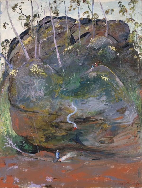
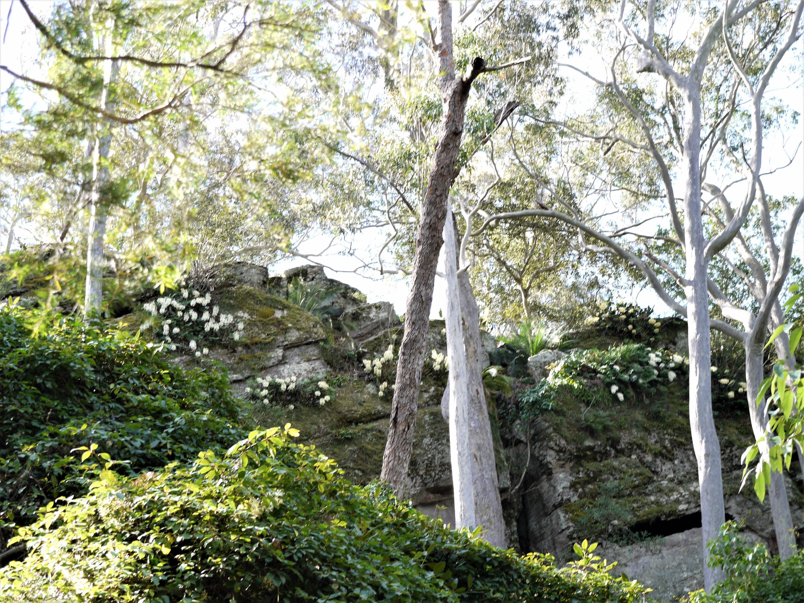
The Amphitheatre
The amphitheatre is an example of the geology of the region with its boulders, caves and tall trees. It has been the inspiration for many works by Arthur Boyd and artists in residence.
Nowra Sandstone
The predominant rock formation in the area is Nowra Sandstone, characterised by layers of stone and pebbles. Nowra sandstone is part of a Permian rock sequence (279-230 Million years ago). The Permian period was a time when reptiles and large non-flowering plants dominated the earth and at that time this area was subsiding and was covered by sea.
This depression is called the Sydney Basin because its’ centre lies in Botany Bay. The remains of melting Icebergs dropped sand, pebbles and small stones onto the sea bed, while rivers deposited many layers of small pebbles, sands and mud over a large area. Abundant fossils of shellfish are found in the lower part of the Nowra sandstone, which indicate that these sedimentary rocks were laid down in shallow water. The resulting sandstone was elevated 600 metres about 100 million years ago and the Shoalhaven River eroded the valley. The sea flooded the valley as far as Burrier.
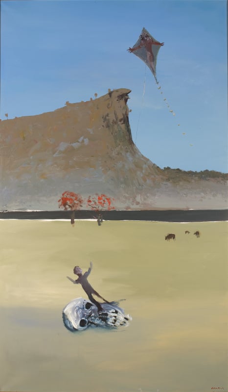
Pulpit Rock
Opposite the Homestead is Pulpit Rock, the subject of many of Arthur Boyd’s paintings.
Indigenous Meaning
Pulpit Rock, has significant connections with local Indigenous people. In aboriginal cultural heritage, spiritually, the landscape is imbued with meaning, embedded in prominent topographic features. Creation/dreaming stories for the Shoalhaven River have been recorded and connect to landforms surrounding the river.
During interviews for the Lower Shoalhaven River Valley Aboriginal Cultural Mapping Place Project, local Aboriginal man David Thomas remembers, while picking peas at Bamarang [probably in the 1950s-1960s], looking up at Pulpit Rock and seeing the outline of a man with a spear standing on the cliff. In the same study, Aboriginal man George Perry talks about caves in Pulpit Rock being the home of the ‘little hairy man – a Dooligal – and old yellow boy’. As a child he was too scared to go up there. He said the electric fences in the paddocks were to keep the hairy man from stealing the cows.
Soils
Soils are the result of deposition and erosion and determine characteristics of vegetation communities.
Bushland topsoil
The soils in the un-grazed steep bushland areas have relatively deep mulch layers and have greater plant species richness. The south facing slopes behind the Homestead, to the north, are protected from the northern aspect and are well vegetated and correspondingly the soils have higher levels of organic matter. The soils are generally silty-sandy soils and are highly erodable. The bushland topsoils that have been grazed are generally on steeper ground and are situated below rock outcrops. They have lost their native vegetation cover (which binds the soil surface) and are subsequently depleted. The organic soil horizon is very thin and the volume of decaying mulch is similarly thin and the fertility is correspondingly low. The steepness of the ground suggests that surface erosion has removed much of the organic matter and the A-soil horizon. Much of this bushland has also been infested with Lantana
Paddock topsoil
The soils in the paddocks are silty – sandy soils that have some structure. If consistent with the silt content they should have moderate colloidal capacity, moderate water holding capacity and with the sand content should also be well drained and have reasonable air filled porosity. At first inspection they appear to be moderately fertile and suitable for a range of agricultural uses.
Soil Erosion and Sedimentation
The soils within the arable lands on site are stable (non-eroding) apart from the river banks which have been de-stabilised through the action of Wombats digging into the river banks; the wave, wind, a tide action of the river and rain/sheet erosion on the four wheel drive tracks leading across the paddocks and to Haunted Point and the Amphitheatre.